Gordin and I drove out too Cooper’s cove and joined Gerhardt and some other “SKUNCS” (Rob, Muriel, Felicity) for a nice paddle in the inlet. There was a nice easterly wind to begin with so I put up my small Spiritsail and Gerhardt put up his Windpaddle (photo below). I really like the idea of the windpaddle as it can be easily ported from one boat to another with no deck rigging. Probably not wuite as effective as the spirit sail or the pacific action sail, but good all the same. We stopped by the “Florence Folberg” which was aground and rather wrecked on a sandbar in the basin. After the wreck, Gordin and I paddled on over to his in-law’s for a lunch stop. We had a nice flood to assist us on the way back which more than made up for the wind in our faces.


 the wreck of the Florence Folberg

I was also testing out my new SPOT satellite tracker. This also worked well. I received a few sample messages such as the one below:
SPOT Check OK. MJ is Fine!
Unit Number: 0-7349589
Latitude: 48.3939
Longitude: -123.6547
Nearest Town from unit Location: Unknown
Distance to the nearest town: Unknown
Time in GMT the message was sent: 02/24/2008 18:02:34
http://maps.google.com/maps?f=q&hl=en&geocode=&q=48.3939,-123.6547&ie=UTF8&z=12&om=1
I also have a google earth file of the record made by the SPOT tracker. http://www.islandnet.com/~mjackson/spot_messages_sooke.kmz

One test message took 1.5 mins from me pressing the button to receiving the text message on my cell phone.
You can see the device “in hand” at http://flickr.com/photos/chaffneue/2287365121/in/set-72157603971935680/ on Rich’s web site


 14.5 km, 8 NM, YTD 94 km
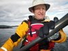

